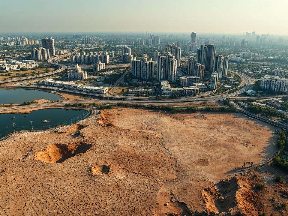
HYDERABAD: A recent study reveals that Hyderabad has seen its water bodies shrink by nearly 500% from 2000 to 2020, decreasing from 12,535 hectares to just 2,280 hectares. This significant reduction has had a detrimental effect on the city’s natural water network. Concurrently, built-up areas have doubled from approximately 38,863 hectares to 80,111 hectares. Consequently, water levels in major lakes like Osmansagar, Himayatsagar, and Durgam Cheruvu have plummeted, pushing the city towards a critical water scarcity.
M. Kamraju, a former research scholar from the Center for Economic and Studies, stated, “These water bodies—crucial for groundwater recharge and biodiversity—have been encroached upon, polluted, or allowed to decay. This has led to a decline in both the quality and availability of water.” The study, published in Earth Sciences Malaysia, attributes this shift to rapid urbanization and industrialization caused by the growth of IT hubs, commercial centers, and residential townships, with Hi-Tec City, Gachibowli, and the Financial District being major contributors.
Over nearly two and a half years, the researcher found that the number of lakes in Hyderabad has decreased sharply from around 3,500 to only 650 in the past two decades.
“Despite some sporadic conservation efforts, they are insufficient to counter the relentless pressures of urbanization,” he remarked. The negative impact is evident in the low groundwater levels, even after heavy rainfall in almost 90% of Greater Hyderabad. Data from the Telangana groundwater department shows that areas like Malkajgiri, Ameerpet, Kukatpally, and Alwal face critically low groundwater levels during August, leading to a soaring demand for water tankers, which rose to nearly 10,000 per day during the peak months of April and May.
Experts point out that adequate green zones and water bodies, essential for ecological balance, are glaringly absent from the city’s urbanization strategy. A balanced share of open space was crucial during expansive development, yet Hyderabad’s growth model exhibits clear imbalances.
“The consequences are already visible: unregulated flooding during rains, unpredictable rainfall patterns, and tremors in certain areas as land and water systems bear stress. This trend is set to worsen in the coming years,” stated KM Lakshmana Rao, a retired professor from JNTUH and disaster management expert.
Researchers stress the need for policy measures to prioritize green infrastructure, improved land-use management, and stronger environmental conservation efforts to address growing ecological challenges.
“Urban governance in Hyderabad should shift from reactive infrastructure development to proactive spatial planning that includes green buffers, protects natural drainage systems, and emphasizes sustainable land use. Implementing strategies like urban growth boundaries, promoting vertical development over horizontal expansion, conserving remaining green spaces, and restoring degraded water bodies can enhance the city’s urban ecosystem’s resilience and sustainability,” added Kamraju.
Decline in Crop Area
A steep decline in rainfed crop areas has been observed, falling from 72,817 hectares in 2000 to just 37,902 hectares by 2020. This significant contraction reflects a growing trend of farmland conversion into residential, commercial, and industrial zones, significantly reducing opportunities for rainfed farming due to the expansion of housing projects, business complexes, and infrastructure developments.